Projects
Current Projects
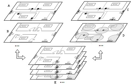
MLSLM: Multi-Layered Semantic Location Model in Ubiquitous Computing Environments
2013 ¨C 2016
The project was supported by the National Natural Science Foundation of China. It aims to build a multi-layered semantic location model to support enhanced semantic location services, like ¡°Position queries,Nearest neighbor queries, Range queries, Navigation and Visualization¡± for context-aware applications in ubiquitous computing environments especially indoor space. The key technology is association mapping approaches between layers based on static and dynamic context and topology information.
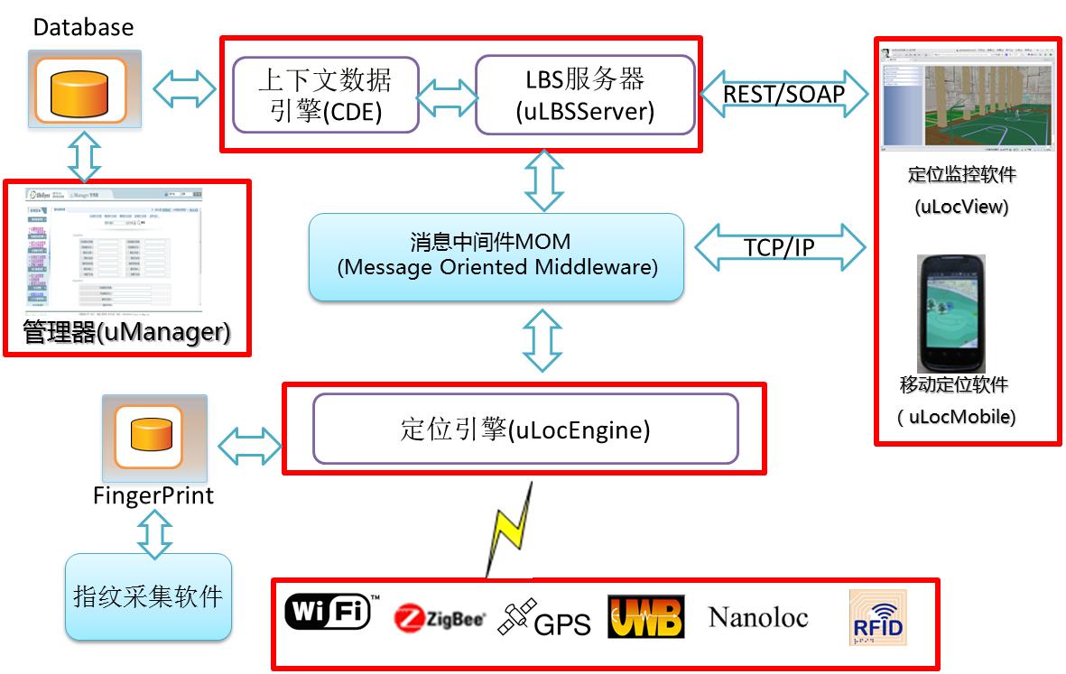
UbiEyes: Universal Real-time Locating System
2012 ¨C2014
UbiEyes RTLS is an independent software platform used to build and support real-time locating or location-aware applications written in Java. The platform includes several core service components, such as Localization Engine (uLocEngine), LBS Server (LBS Server), Context Data Engine (CDE) and Message-Oriented Middleware (MOM), as well as several application software like location monitoring software (uLocView), mobile Location-based application software (uLocMobile) and system management software (uManager). The platform supports different location technologies including GPS, nanoLOC, ZigBee, Wi-Fi and RFID, and uses a variety of strategies to achieve improved positioning accuracy. It also combines the location model to provide basic indoor location-based services.
OBSTracker: Releasing and Positioning technology of OBS
2011 ¨C2012
The project was supported by the Important National Science & Technology Specific Projects of China. An Ocean-Bottom Seismometer (OBS) is a seismometer that can be deployed on the seafloor for weeks or months, recording either earthquakes or man-made seismic signals. The project mainly concerns how to get precise position of OBS during or after deploying it to a subsea location. The ultimate goal of this project is the development of a real-time 2D/3D geographic information system software, namely OBSNavGIS, which can implement the position tracking and navigation of OBS in the process of being released.
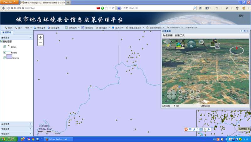
UGESWebGIS: Information Management Platform for Urban Geological Environment Security
2012 ¨C2015
The project was sponsored by the 12th Five-Year Plan key projects supported by National Science and Technology of China.The primary objective of the project is to develop a web-based software system with multi-source database, evaluation model library, generating thematic maps and GIS spatial analysis functions written in Java with ArcGIS Server web service. The system can assist the management of urban geological disaster and the control of geological environment safety, like geological environment monitoring, evaluation, results visualization (2D & 3D) and geological disasters prevention and control.
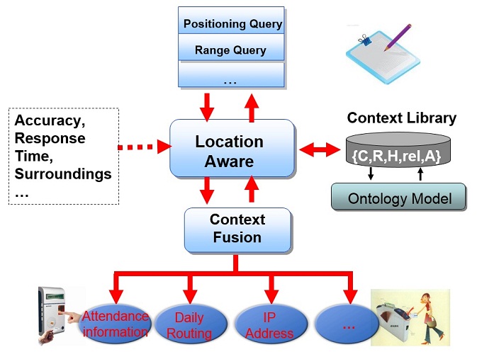
OntoLM: Ontology-based Location Models in Ubiquitous Computing Environments
2009 ¨C2012
The project was supported by the Special Fund for Basic Scientific Research of Central Colleges, China University of Geosciences£¨Wuhan£©for Outstanding Young Faculty. In ubiquitous computing environment, applications or users usually interest locations or spatial relationships of objects, it is necessary to provide the description of distance or range information of the objects. An ontology-based location model is built to support these location services, which can satisfy the requirements of location-related information sharing and reasoning.